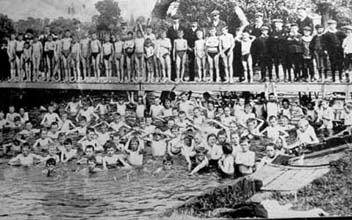
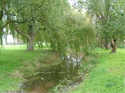
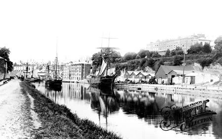
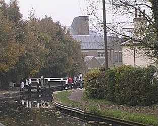
Grand Union Series - Bridge 79D The Willow Pattern by Norfolk12 (2/1.5)


Code: GC12RD3 N52° 03.705 W0° 44.364 (WGS84)
UTM 30U E 654968 N 5770318
Size:  Micro Hidden on 06/05/2007
In Nil, United Kingdom Micro Hidden on 06/05/2007
In Nil, United Kingdom
Part of the Grand Union Series, as always take care with
pets/children as the cache is near the water. Suitable for
buggies/wheelchairs although the final hide involves a grassy area.

The Grand Union Canal links Birmingham to London with a waterway
which is 145 miles long and contains 166 locks. This cache is one
of a series to be found along or close to the Buckinghamshire
stretch of the canal.
I HAVE ALWAYS LOVED THE WILLOW PATTERN PLATES THAT USED TO BE ON MY
GRANDMOTHERS DRESSER AND THIS BRIDGE REMINDED ME OF THEM HENCE THE
NAME
It is not known really whether the pattern was made to
illustrate the story, or the romance suggested by the design.
Every one in childhood has wondered what the mysterious people,
trees, and birds meant. Who are the three people on the bridge and
where are they going? What is the boatman doing? Who lives on the
island? Why do the two birds fly above all, about to kiss each
other? Whatever sized plate or whatever shaped piece we examine
these items occur – the three people are on the bridge, the
boatman, the island, and the birds fluttering above are always
there. Look at the plate – on the right is a Chinese House
belonging to a wealthy man, for it is two storeys high – and the
outbuildings, spacious grounds, and rare trees all indicate
magnificence.
Now for the story
The great house belonged to a Mandarin of great power whose
influence was felt by all in that Seaport. He has acquired much
wealth by serving the Emperor as a Customs House Officer. This work
was done by his secretary named Chang – while his master received
bribes from merchants at whose smuggling he winked as long as he
was paid in proportion. Time came when the merchants began to talk
loudly about the unfairness and dishonesty of this Customs Manager.
As matters had become difficult, the Mandarin whose wife had died
made this an excuse for requesting the Emperor to allow him to
retire. His Imperial Majesty the Emperor signed the necessary
document. The Mandarin then retired to his house with his wealth
untouched, taking with him his only daughter Koong-se, and his
secretary, Chang, whose services he retained for a few months in
order to put his accounts into a state that would bear scrutiny, if
for any reason he should be asked to produce them. When this was
complete, he discharged Chang, but it was too late for the
secretary had seen and loved the Mandarin’s daughter.
At sunset Koong-se used to linger on the way from the banquet
room, and find an opportunity to steal away into a distant part of
the grounds where Chang was ready to meet her, and upon the last
evening of Chang’s engagement he made a promise of love and
constancy.
For many evenings after when Chang was supposed to be miles
away, they met in a place among the orange trees and huge
peonies.
Koong-se’s handmaid assisted to arrange these interviews without
the knowledge of the old Mandarin, for they knew that their
positions in life being unequal, the father would never consent to
the union. Yet they believed and hoped this objection would
sometime be removed.
Their fancy had but two seasons – Spring and Summer.
But the knowledge of these meetings at last reached the Mandarin
– he forbade Koong-se to leave the house, Chang was warned, and he
ordered a high and strong palisade to be made all round the ground
to the edge of the river.
So as to keep his daughter imprisoned and to allow her exercise
in the fresh air he built a suite of apartments adjoining his
banquet room, jutting out over the river, with terraces upon which
Koong-se could walk. These apartments had no exit except through
the banquet room where the old Mandarin spent most of his time, and
as they were completely surrounded by water, he felt sure he would
no longer be troubled with clandestine meetings.
To complete the lovers’ disappointment he betrothed his daughter
to a wealthy friend, a Ta-jin (duke of high degree) whom she had
never seen.
The Ta-jin was her equal in every way, except age, in which he
was greatly her superior.
The marriage was arranged, without the lady’s consent, and was
to take place when the peach tree blossomed.
Poor Koong-se watched the buds on the peach tree that grew near
her prison. But she was cheered when a bird came and built its nest
just close to the window. She watched it bringing straws and
feathers, and used to sit gazing out over the water. As she looked
she saw a coconut shell with a little sail of paper fitted to it
floating towards her, and stretching out her parasol she reached it
from the water. In it she found a bead she had given to her lover,
and some verses, which proved from whom it had come.
Chang had sent it from the other side of the water, and upon
closer examination she found a paper, on which was written: “As
this boat sails to thee, so my thoughts tend” With further
information that, when the Willow blossom drops from the bough, and
the peach tree unfolds its buds, your faithful Chang will sink with
the lotus blooms beneath the deep waters.
Koong-se well understood this and wept over Chang’s threat to
commit suicide. She took a needle that she had been using for
embroidery and scratched upon an ivory tablet, her answer: “Do not
wise husbandmen gather the fruits they fear will be stolen? The
fruit you most prize will be gathered when the Willow blossom
droops upon the bough” She placed the tablet in the shell boat, and
when dark launched it with an incense stick burning in it, and
little faith in her heart.
Still she followed its light till she could see it no longer,
and because it had not overturned or the light extinguished, with a
lighter heart she retired to rest.
Days passed, weeks passed, but no more little boats appeared,
and Koong-se began to doubt.
The blossom upon the Willow tree, as she watched it, seemed to
wither.
One morning the old Mandarin came to her in high glee. In his
hands was a large box full of rare jewels – a present from the
Ta-jin.
He told her that the Duke was coming that day to take food and
drink wine in her father’s house.
Koong-se’s hopes vanished – she could only weep. The Ta-jin
arrived with a great crowd of servants bearing lanterns on which
were written his titles, and his great performances, which were
shouted out between the beating of gongs.
The old Mandarin gave him a suitable reception, and the
gentleman sat down to a feast, many “cups of salutation” were drunk
and they became noisy with merriment.
During this orgy a stranger came to the house to ask alms, and
his tale being listened to he took a garment from the porch, in
which he disguised himself, and spreading a screen across the lower
part of the banquet room, he passed into Koong-se’s apartments, and
in another moment the lovers were locked in each other’s arms.
Yes! It was Chang, he asked Koong-se to fly with him, “for,”
said he, “… the Willow blossom already droops upon the bough.” She
gave him the box of jewels, and as the Mandarin and his guests were
asleep over their cups, she passed behind the screen and out down
the steps to the footbridge beside the Willow tree.
At this moment the old Mandarin became aware of what was going
on, and seeing his daughter and Chang in the garden he raised the
hue and cry and ran out after them himself.
Here you have the part of the story, which shows the three
figures on the bridge (the artist has had to concentrate them upon
the bridge, so as to show them clearly, as well as to help the
design).
First the lady – Koong-se holding a distaff, the emblem of
virginity – the second is Chang carrying the box of jewels – the
third, the old Mandarin showing his authority and rage as he
carries a whip.
Chang and Koong-se escaped and got into a boat, which was in
readiness, and rowed away to an unfrequented island far away on the
river, where the handmaid, who had been dismissed, found them
safety, and concealed them.
Every attempt to race them was made by the father and Ta-jin –
the former, after a short time, gave up in despair – but the
latter, who was more persevering, sent spies out to every village
for miles around, he was anxious to secure Chang, and put him to
death for the theft of the jewels.
At last the old Mandarin issued a proclamation that, if his
daughter would leave Chang and return home, he would forgive
her.
This deluded Chang into believing that he was relenting and he
was so joyful that he became less careful to conceal himself. Thus
the house was watched, and later in the evening a soldier entered
to read the proclamation to them, and tell them the house was
surrounded.
Chang managed to escape by diving into the river, and swimming
across, he fetched a boat after dark. While the faithful handmaid
kept the soldiers occupied in front of the house Koong-se escaped
by the back, and the boat was pushed off and went rapidly down the
river.
They sold a jewel and brought food with the coin. They floated
on for several days till they came to an island in the broad river
near its mouth at the sea, and on this small piece of ground they
decided to settle and live in peace.
The jewels were sold in secret ways so as to avoid suspicion,
and with the proceeds Chang was able to purchase a free right to
the island.
Here they built a house, Koong-se helping, and Chang brought the
land into a profitable state of cultivation.
This you can see in the design for the whole of the ground is
furrowed and every scrap of it is utilised – even narrow strips of
land are reclaimed from the river.
Chang became by his industry a man of comfortable means, and
took up once more his literary pursuits, writing a book upon
gardening, which gained him reputation and the patronage of wealthy
men.
This book made him friends, but also showed his whereabouts to
his greatest enemy the Ta-jin, whose desire for revenge had never
ceased.
He did not delay but sent at once a company of soldiers to seize
Koong-se and kill Chang without mercy. Chang resisted them but was
run through the body and mortally wounded. His servants seeing him
fall, threw down their weapons and fled.,P. Koong-se in despair ran
into the house which she set on fire, and was burnt to death. The
gods cursed the Duke, but took pity on Koong-se and Chang they
transformed them into two immortal doves (or in reality a mandarin
duck and drake), emblems of constancy – beautiful in life, and in
death unparted.
The fact in natural history is: That if a Mandarin drake dies,
his mate also dies, and vice-versa. This story was written by Harry
Barnard.
NOW TO THE CACHE YOU ARE LOOKING FOR A CAMEO-MICRO
CONGRAT'S TO TIKAL FTF
Additional hints: hanging around
|
 Regular Hidden on 11/03/2007
In Nil, United Kingdom
Regular Hidden on 11/03/2007
In Nil, United Kingdom  (This cache may contain travel bugs)


 Other Hidden on 20/08/2007
In Nil, United Kingdom
Other Hidden on 20/08/2007
In Nil, United Kingdom 
 Small Hidden on 10/04/2008
In Nil, United Kingdom
Small Hidden on 10/04/2008
In Nil, United Kingdom 


 Blaise Hamlet (Bristol) by The Wombles (1.5/1.5)

 plans to defect in the Soviet Union's newest missile
submarine,
plans to defect in the Soviet Union's newest missile
submarine,


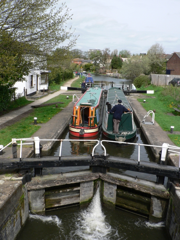
 This cache is located at the Duck Pond near the car park at Rushall
Farm, and should round off your walk nicely. Please take care to
replace the cache as found, and ensure it is well covered. It
contains a logbook and a pencil. There is no room in the cache
itself for trades, but it is possible to leave trades if you wish.
All will be revealed when you find the cache. No trades were left
at the time of placing.
This cache is located at the Duck Pond near the car park at Rushall
Farm, and should round off your walk nicely. Please take care to
replace the cache as found, and ensure it is well covered. It
contains a logbook and a pencil. There is no room in the cache
itself for trades, but it is possible to leave trades if you wish.
All will be revealed when you find the cache. No trades were left
at the time of placing. This cache is the fourth part in a fairly circular walk placed for
the Caching Christmas Cracker 2007 event at Rushall Farm.
This cache is the fourth part in a fairly circular walk placed for
the Caching Christmas Cracker 2007 event at Rushall Farm.  This cache is the fifth part in a fairly circular walk placed for
the Caching Christmas Cracker 2007 event at Rushall Farm. The sixth
part is the Earth Cache which you will visit next.
This cache is the fifth part in a fairly circular walk placed for
the Caching Christmas Cracker 2007 event at Rushall Farm. The sixth
part is the Earth Cache which you will visit next. 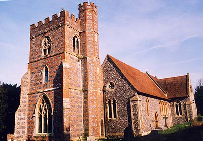


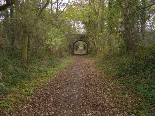
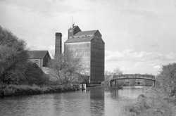
 Maidenhead Railway Bridge is a railway bridge
carrying the main line of the Great Western Railway over the River
Thames in Maidenhead, Berkshire, England. The bridge was designed
by the Great Western's famous engineer, Isambard Kingdom Brunel.
The railway is carried across the river on two brick arches, which
at the time of building were the widest and flattest in the world.
Each span is 128 feet (39 m), with a rise of only 24 feet (7 m).
The Thames towpath passes under the right-hand arch (facing
upstream), which is also known as the Sounding Arch, because of its
spectacular echo. It was completed in 1838.
Maidenhead Railway Bridge is a railway bridge
carrying the main line of the Great Western Railway over the River
Thames in Maidenhead, Berkshire, England. The bridge was designed
by the Great Western's famous engineer, Isambard Kingdom Brunel.
The railway is carried across the river on two brick arches, which
at the time of building were the widest and flattest in the world.
Each span is 128 feet (39 m), with a rise of only 24 feet (7 m).
The Thames towpath passes under the right-hand arch (facing
upstream), which is also known as the Sounding Arch, because of its
spectacular echo. It was completed in 1838.


 (ref =
  Small disguised cache containing
logbook bring your own pen. Also make a note of the numbers
for the YABBA-DABBA-DOO Bedrock bonus cache.Do not remove the
numbers from the cache. Please take care when replacing cache
to keep it intact. There is a short stretch along a road,
little cachers beware. Path could be muddy when wet, rough in
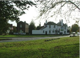
places. The Greyhound pub in the village is a good stop for
refreshments.
Small disguised cache containing
logbook bring your own pen. Also make a note of the numbers
for the YABBA-DABBA-DOO Bedrock bonus cache.Do not remove the
numbers from the cache. Please take care when replacing cache
to keep it intact. There is a short stretch along a road,
little cachers beware. Path could be muddy when wet, rough in
places. The Greyhound pub in the village is a good stop for
refreshments. Small disguised cache containing
logbook bring your own pen. Also make a note of the numbers
for the YABBA-DABBA-DOO Bedrock bonus cache.Do not remove the
numbers from the cache. Please take care when replacing cache
to keep it intact. The Greyhound pub in the village is a good
stop for refreshments.
Small disguised cache containing
logbook bring your own pen. Also make a note of the numbers
for the YABBA-DABBA-DOO Bedrock bonus cache.Do not remove the
numbers from the cache. Please take care when replacing cache
to keep it intact. The Greyhound pub in the village is a good
stop for refreshments. Large Hidden on 01/04/2007
In none, United Kingdom
Large Hidden on 01/04/2007
In none, United Kingdom 


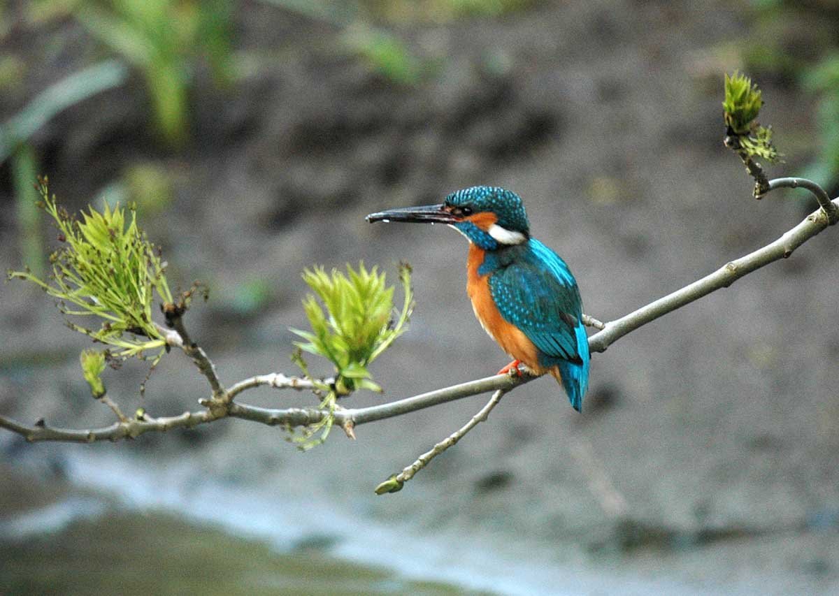


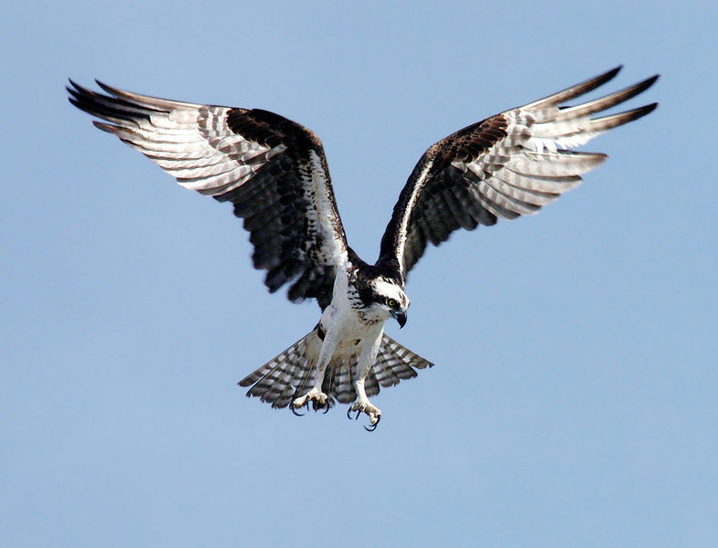 "Pandion
haliaetus" is the latin name for the osprey. More often
associated with Scotland, during their migrations they can be
spotted on any large body of freshwater. Migration takes place
between March and April in the Spring and between August and
September in the late Summer.
"Pandion
haliaetus" is the latin name for the osprey. More often
associated with Scotland, during their migrations they can be
spotted on any large body of freshwater. Migration takes place
between March and April in the Spring and between August and
September in the late Summer.
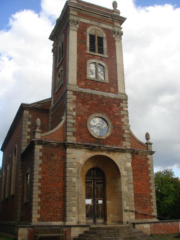
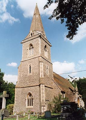
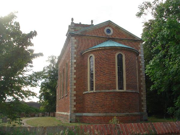 Willen Church is
one of the few know building of Robert Hooke’s that
survives relatively unchanged. It was built for Dr Richard
Busby who was headmaster of Westminster school for over 50
years; also a lifelong friend of Robert Hook, who attended the
school and lodged with Busby. The church was completed in
1680.
Willen Church is
one of the few know building of Robert Hooke’s that
survives relatively unchanged. It was built for Dr Richard
Busby who was headmaster of Westminster school for over 50
years; also a lifelong friend of Robert Hook, who attended the
school and lodged with Busby. The church was completed in
1680.